
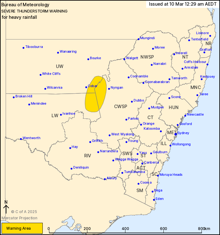
Source: Bureau of Meteorology
For people in parts of Central West Slopes and Plains, Lower
Western and Upper Western Forecast Districts.
Issued at 12:29 am Monday, 10 March 2025.
Severe thunderstorms continue east Cobar this evening.
Weather Situation: A moist, unstable airmass combined with an
upper trough is supporting severe thunderstorms across the interior
of the state this evening.
Severe thunderstorms are likely to produce heavy rainfall that may
lead to flash flooding in the warning area over the next several
hours.
45.6 mm was recorded at Cobar in the 1 hour to 11:15 pm.
44.4 mm was recorded at Cobar Airport in the 1 hour 30 minutes to
11:30 pm.
39.4 mm was recorded at Noona (west of Cobar) in the 1 hour 15
minutes to 9:30 pm.
91 km/h wind gust has been recorded at White Cliffs Airport at
2:11 pm.
The State Emergency Service advises that people should:
* Keep clear of creeks and storm drains.
* Don't walk, ride your bike or drive through flood water.
* If you are trapped by flash flooding, seek refuge in the highest
available place and ring 000 if you need rescue.
* Be aware that run-off from rainfall in fire affected areas may
behave differently and be more rapid. It may also contain debris
such as ash, soil, trees and rocks.
* After bushfires, heavy rain and the loss of foliage can make the
ground soft and heavy, leading to a greater chance of
landslides.
* Unplug computers and appliances.
* Avoid using the phone during the storm.
* Stay indoors away from windows, and keep children and pets
indoors as well.
* Stay vigilant and monitor conditions. Note that the landscape
may have changed following bushfires.
* For emergency help in floods and storms, ring the SES (NSW and
ACT) on 132 500.
09/Mar/2025 01:37 PM


