
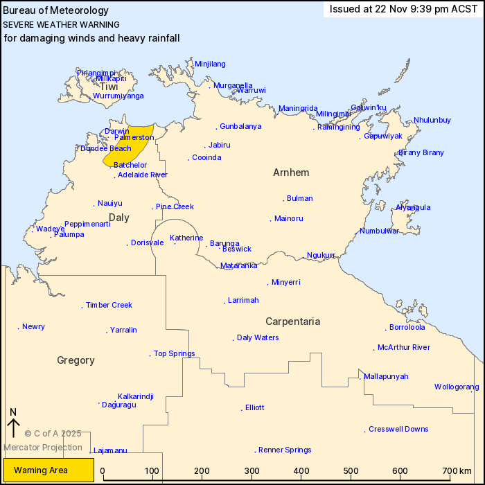
Source: Bureau of Meteorology
For people in parts of Daly district.
Issued at 9:39 pm Saturday, 22 November 2025.
Heavy rainfall and damaging winds possible in a rainband to the
east of Severe Tropical Cyclone Fina.
Weather Situation: Severe Tropical Cyclone Fina is moving
west-southwest along the southern coast of the Tiwi Islands. A band
of heavy rain is extending from Severe Tropical Cyclone Fina to the
east affecting northern parts of the Daly district.
HEAVY RAINFALL which may lead to FLASH FLOODING is likely in the
warning area. Six hourly totals of 100 to 120 mm are expected, with
isolated totals of 150 mm possible. 24-hourly totals of up to 250
mm are possible.
DAMAGING WINDS averaging 55 to 65 km/h with peak gusts up to 100
km/h are possible with showers and thunderstorms.
A Tropical Cyclone Advice and various Flood Watches/Warnings are
also current. Please refer to
https://www.bom.gov.au/weather-and-climate/warnings-and-alerts.
The Northern Territory Emergency Service advises that people
should:
* secure loose outside objects and seek shelter when conditions
deteriorate
* pull over if it is raining heavily and you cannot see, park with
your hazard lights on until the rain clears
* avoid driving into water of unknown depth and current
* create your own sandbags if there is flooding, by using pillow
cases or shopping bags filled with sand and place them around
doorways to protect your home
* stay away from flooded drains, rivers, streams and
waterways
* ensure pets and animals are safe
* be prepared in case of power outages, have an emergency kit with
a radio, torch, spare batteries and first aid kit
* for emergency help in floods, storms and cyclones, contact the
NTES on 132 500. For more safety tips visit
www.securent.nt.gov.au
22/Nov/2025 12:18 PM

