
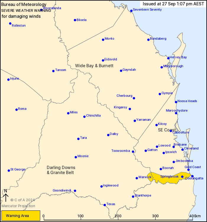
Source: Bureau of Meteorology
For people in parts of Southeast Coast and Darling Downs and
Granite Belt Forecast Districts.
Issued at 1:07 pm Friday, 27 September 2024.
Damaging wind gusts to develop about the Scenic Rim and far
southeast coast this evening, easing later on Saturday.
Weather situation: A low pressure system developing offshore of
the southeast coast will track close to the coast overnight,
generating a vigorous south to southeasterly flow along the coast
and into the Border Ranges. Winds will increase overnight Friday
into Saturday morning, before easing into Saturday evening as the
low is forecast to move further offshore.
DAMAGING SOUTH TO SOUTHEASTERLY WIND GUSTS of around 90 km/h are
expected to develop about the Scenic Rim and parts of the far
southeastern coast overnight tonight into Saturday morning.
Winds are expected remain gusty throughout Saturday before easing
below warning thresholds by the late afternoon or early evening on
Saturday.
Locations which may be affected include Coolangatta and
Springbrook.
Emergency services advise people to:
* Park your car undercover away from trees.
* Close doors and windows.
* Keep asthma medications close by. Storms and wind can trigger
asthma attacks.
* Charge mobile phones and power banks in case the power goes
out.
* Put your pets somewhere safe and make sure they can be
identified in case they get lost.
* Do not drive now unless you have to because conditions are
dangerous.
* Tell friends, family and neighbours in the area.
* Go inside a strong building now. Stay inside until the storm has
passed.
27/Sep/2024 03:20 AM


