
Source: Bureau of Meteorology
For people in parts of Channel Country Forecast District.
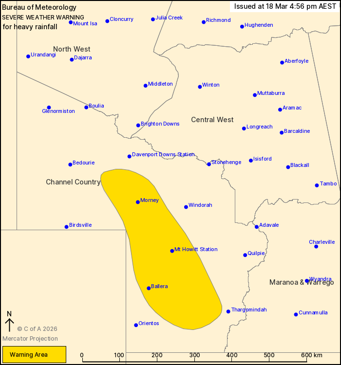
Issued at 4:56 pm Wednesday, 18 March 2026.
Heavy rainfall risk continuing about the central Channel Country
into this evening.
Weather Situation: A rich tropical airmass extends over the centre
of the country with a surface trough extending into the far
southwest of Queensland. Meanwhile an upper trough is moving across
eastern South Australia. This combination is bringing the risk of
heavy rainfall to the far southwest of the state today. The upper
trough will clear to the east overnight into Thursday morning with
conditions expected to ease over the warning area.
HEAVY RAINFALL which may lead to FLASH FLOODING is forecast for
central parts of the Channel Country district this afternoon and
into the evening. Six-hour rainfall totals between 30 and 60 mm are
possible, especially with thunderstorms.
Conditions are expected to ease below warning thresholds late this
evening.
Flood Warnings are current for the area. Please refer to
https://www.bom.gov.au/weather-and-climate/warnings-and-alerts/ for
more information.
Locations which may be affected include Ballera, Mt Howitt Station
and Morney.
Emergency services advise people to:
* Park your car undercover away from trees.
* Close doors and windows.
* Keep asthma medications close by. Storms and wind can trigger
asthma attacks.
* Charge mobile phones and power banks in case the power goes
out.
* Put your pets somewhere safe and make sure they can be
identified in case they get lost.
* Do not drive now unless you have to because conditions are
dangerous.
* Tell friends, family and neighbours in the area.
* Go inside a strong building now. Stay inside until the storm has
passed.
18/Mar/2026 07:01 AM

